

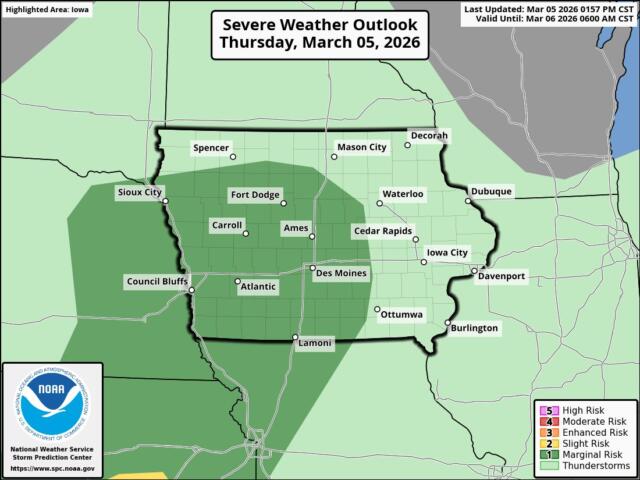
KICD Weather Room 12 p.m. (noon) Thursday update — The forecast from today into Saturday hasn’t changed much. Today will be warm and breezy, with very high fire danger in western areas this afternoon and evening. A system moving out of the Rockies will bring the first real round of showers and thunderstorms of the year tonight, mainly after midnight, roughly between 12 and 7 a.m. tomorrow morning. A few storms south of Interstate 90 could become strong to severe, with quarter-sized hail being the main concern and a small chance of wind gusts near 60 mph.
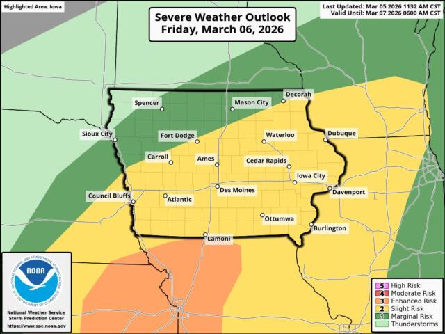
On Friday, off-and-on rain showers and possibly thunderstorms are expected, though forecast models vary on how widespread they’ll be. The chance for isolated severe storms depends on how quickly the cold front moves through, which is still uncertain by several hours. It also depends on the placement of the front — if it sets up farther north or farther south, we could miss out on stronger storms Friday afternoon and early evening. However, the best chance for strong storms remains in our southern and far southeastern counties from Friday afternoon through Friday evening, mainly between 3 and 11 p.m.
From Friday night into Saturday, falling temperatures will cause rain to change to a mix or freezing drizzle before turning to all snow. Snow amounts remain uncertain, including exact placement, but most areas north and west of Spencer are expected to see light totals.
UPDATED 2 P.M. THURSDAY: WINTER WEATHER ADVISORY IN EFFECT FROM 6 PM FRIDAY TO 9 AM CST SATURDAY…
Overall totals in Spencer for Thursday should come in around four-tenths of an inch, with Friday adding slightly less — between two and three-tenths of an inch of rainfall. Total snow accumulation of around one inch will be possible along with ice accumulation up to one fifteenth (0.15) of an inch.