

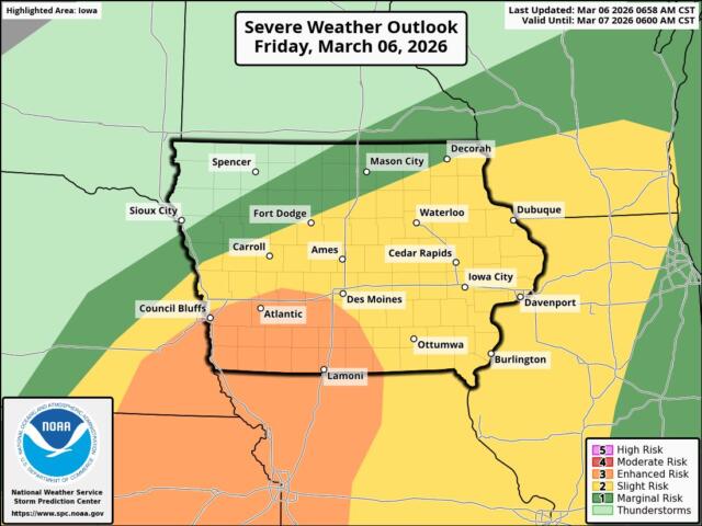
KICD Weather Room, Spencer, IA UPDATED 1:30 P.M. 3/6/26 — In areas not dealing with the wintry mix, spotty showers and a few thunderstorms may pop up—mainly in northwest Iowa this afternoon and evening. A storm or two could produce small hail and wind gusts up to 50 mph, but widespread severe weather isn’t likely due to limited instability.
Forecast models still show a warm layer of air above us, which means most places will get mainly liquid precipitation through late afternoon and early evening. The only area seeing mostly snow will be near and west of the Sioux Falls area, where that warm layer isn’t as strong. For most of the afternoon, many spots will just see drizzle because the lower atmosphere is very moist, but the layer where snow usually forms is too dry to make flakes.
The listening area still remains under a Winter Weather Advisory from 6 p.m. this evening through 9 a.m. tomorrow morning for the possibilities for light ice and snow.
Much drier air arrives later tonight into Saturday morning, bringing an end to the precipitation. A quick‑moving high‑pressure system arrives Saturday, giving the area southwest winds and milder temperatures, with 50s west of I‑29 and 40s east of I‑29.