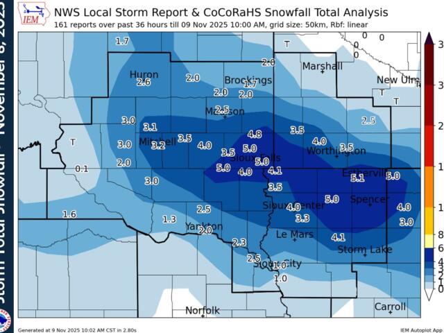

(Sioux Falls, SD NWS) — Winter made its first official appearance, as a significant snowfall moved across the Tri-State area on November 8th. Developing after midnight, the system gradually advanced southeast throughout the day, bringing the region its inaugural measurable accumulation.
The snowfall was notably intense at times, with mid-morning reports indicating rates reached between a half-inch and a full inch per hour. By the time the event concluded, residents across the region reported widespread totals of 1 to 4 inches, though some localized, higher pockets were noted.
The departing storm system ushered in a significant drop in temperatures. Overnight lows in many locations plummeted toward the teens, creating hazardous conditions. Accompanying a surge in wind speed, these frigid conditions contributed to minor snow drifting, further impacting travel and cleanup efforts.
Snowfall totals across the region: