


The main concern today is the chance for severe storms later this afternoon and evening.
The overall forecast has not changed much since yesterday. The biggest question is where a warm boundary sets up, which will affect where storms form. Right now, forecasts place it anywhere from along I‑90 to near or just north of Highway 14.
There is also some uncertainty about whether morning showers and clouds may slow daytime warming. That could affect how strong storms become and where they develop. Some computer models show storms forming in one area, while others show two separate areas.
A low‑pressure system is still expected to move in from Nebraska during the early to mid‑afternoon (around 2–4 PM). Upper‑level support arrives a bit later, which is likely why models show storm development in different locations.
Conditions support very strong storms, with large hail up to 2 inches being the main threat. Damaging winds up to 70 mph are also possible. Because of the warm boundary and how storms may form, a tornado or two cannot be ruled out.
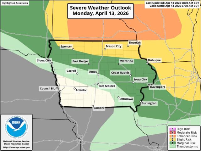
Some storms could start as individual strong storms before merging into a larger complex later on.
Continue to monitor the forecast today and stay weather aware, especially during the late afternoon and evening.