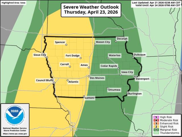

KICD Weather Room 4/21/26 1:00 P.M. Update: A cold front moves across the state Thursday, separating warm air to the east from cooler air behind it. This front could spark storms, but timing and placement are still uncertain.
If storms reach northwest Iowa, it would most likely be late afternoon into early evening. There’s also a chance the front moves through too fast for storms to fully develop here. Any storms that do form would likely be isolated, not widespread.
The main concern would be strong wind gusts, especially if storms organize into a line like some RRFS models suggest. Large hail is also possible with stronger storms. Tornado risk in northwest Iowa is very low — not zero, but not a primary concern.
Everything hinges on how fast the cold front moves. An earlier push would limit instability and weaken storm potential. That’s why this is a lower‑confidence, conditional threat for our area.
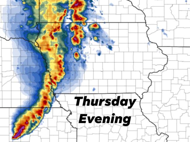
Below are recent model runs for Thursday evening — just one possible outcome. We’re still a couple days out, and details could change, especially once the front’s timing becomes clearer.
RRFS A Model for Thursday…
SPCs Thursday Outlook…