


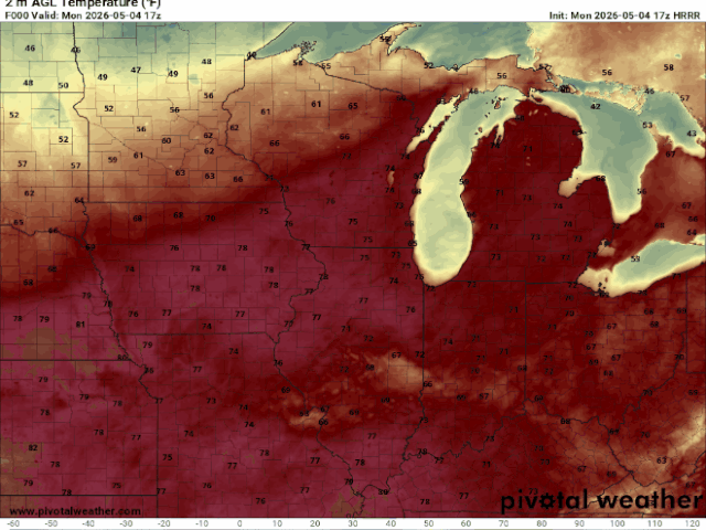
Spencer, IA — Another mild and windy day continues. Winds have turned north behind this morning’s cold front, with gusts of 25–35 mph. Temperatures across the area are mostly in the 50s and 60s. Air is very dry, with humidity around 25–30 percent, which creates some fire danger. However, no fire alerts were issued because vegetation is starting to green up.
Here’s how temperatures look now through late evening:
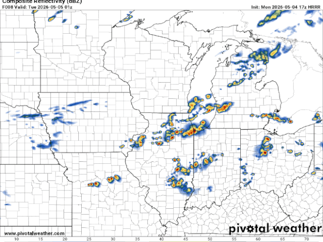
A few light sprinkles are possible this evening along and south of Highway 20, but any rain would be very light. Overnight, clouds will thin out and winds will ease, allowing cooler air to move in. Lows will mainly fall into the low to upper 30s. Patchy frost is possible late tonight, especially near Highway 14, but confidence isn’t high enough yet to issue any frost or freeze alerts.
Cooler weather sticks around through midweek. Winds aloft stay out of the north, keeping temperatures below normal. Highs on Tuesday and Wednesday will mostly be in the low to upper 50s. Nighttime lows will drop to near or below freezing, especially Tuesday and Wednesday nights, which could lead to more widespread frost or freezing conditions. Some uncertainty remains due to clouds and slightly higher humidity.
By Thursday, temperatures should begin to rebound as winds turn more west and southwest. Highs should climb back into the 60s. Rain chances during this time remain very low.
An active weather pattern returns heading into the weekend, with several weather systems moving through. The best chance for rain appears to be Saturday into Sunday, mainly south of I‑90. Rain chances are around 30–40%, and while totals won’t be heavy, some rainfall would still be beneficial. Temperatures will continue warming, with highs mostly in the 60s to low 70s.