


KICD Weather Room Update 6/2/2026 through 6/4/2026 — Thunderstorms never really developed the way forecasts and models expected Wednesday evening and overnight. However, this morning, a few scattered storms developed across northwest Iowa and parts of northeast Nebraska and southwest Minnesota. While a few stronger storms can’t be ruled out, the overall severe weather threat remains low. The main concerns would be hail up to the size of quarters and wind gusts between 50 and 60 miles per hour. But as of now most of the activity moved out of our area at noon.
The greater concern arrives later tonight and into the overnight hours. Conditions will become more favorable for stronger thunderstorms to develop and move across the region. Some storms could organize into a larger complex capable of producing damaging winds, with the strongest gusts potentially reaching 75 miles per hour. Heavy rainfall will also be possible. If the storms weaken somewhat as they move in, wind gusts would likely stay closer to 60 miles per hour, but the threat of heavy rain could increase.
Confidence in tonight’s forecast is somewhat lower than usual because forecast models have struggled with this morning’s thunderstorm activity. That means the exact timing and strength of tonight’s storms may still change.
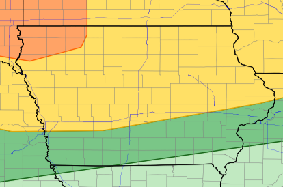
However, the Storm Prediction Center (SPC) has placed Lyon, Sioux, Osceola, O’Brien, Dickinson, and Clay Counties under an Enhanced Risk (Level 3 of 5) for severe weather. The remaining KICD counties—Emmet, Palo Alto, Kossuth, Pocahontas, Buena Vista, and Cherokee—are under a Slight Risk (Level 2 of 5).
Keep in mind that this outlook is focused on late this evening, the overnight hours, and early Friday morning, when the greatest threat for strong to severe storms is expected.
The atmosphere will still have plenty of energy overnight, so storms will be able to stay strong even after sunset.
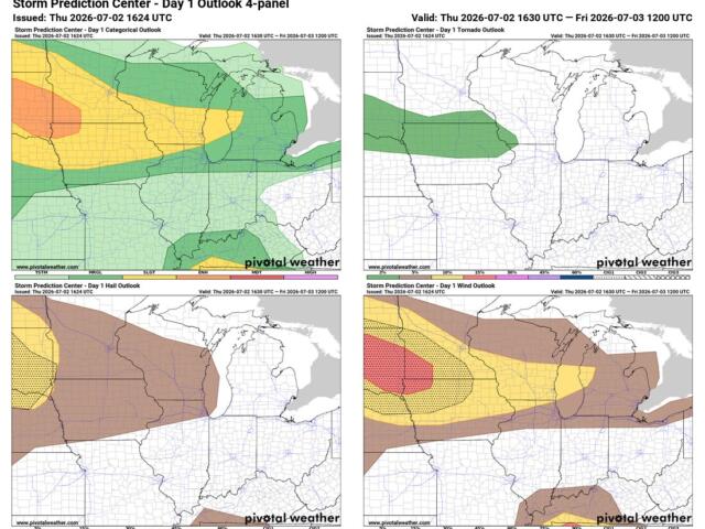
The main concern tonight is damaging straight-line winds, especially if storms come together into a large cluster before moving into the area. Wind gusts of 60 to 75 mph would be possible with the strongest storms.
Heavy rain is also a big concern. The atmosphere is loaded with moisture, which means any storm could produce very heavy downpours in a short amount of time. That could lead to areas of flooding, especially when heavy rain has already fallen recently.
Large hail is a lower threat, and the tornado risk looks very low at this time.
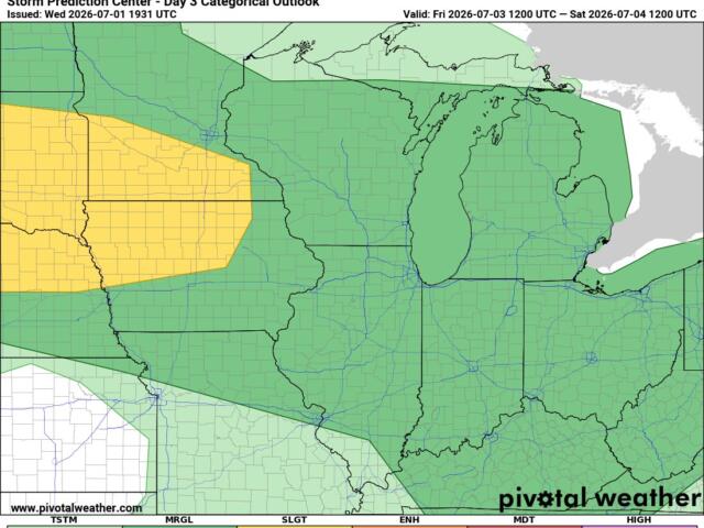
Another round of strong to severe thunderstorms is possible Friday, especially Friday afternoon and evening. All of Iowa remains in a Slight Risk (Level 2 of 5) with the risk of damaging winds and hail, heavy rainfall could become an increasing concern as multiple rounds of storms move through the area.
Looking ahead to the Fourth of July, there is some encouraging news. Current forecast trends suggest much of the day could remain dry. However, with summertime thunderstorm patterns, there’s still time for the forecast to change, so we’ll continue to watch things closely as the holiday approaches.